


THE CRANE FAMILY: MAPS AND SUPPLEMENTAL ITEMS
|
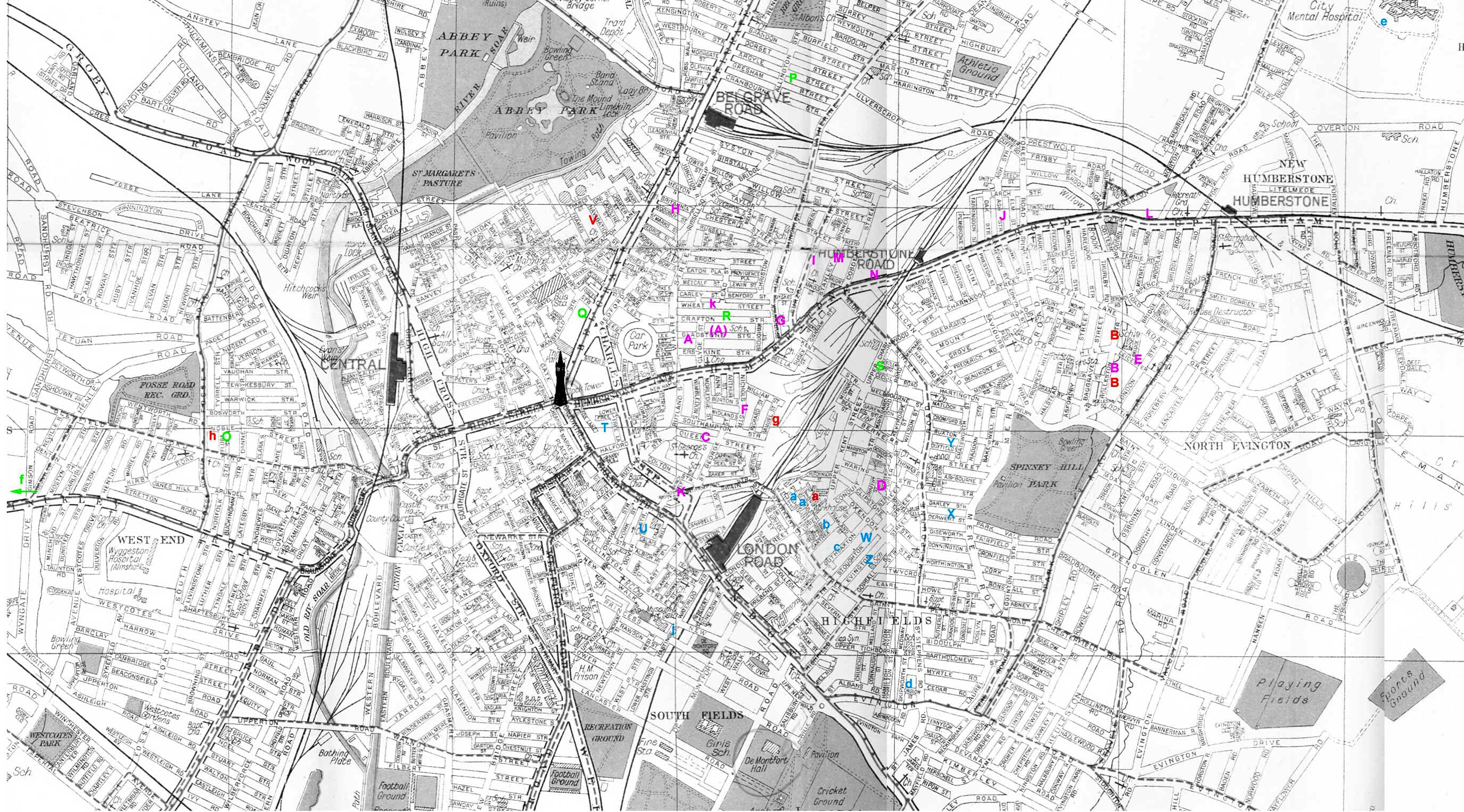
Central Leicester before 1940
In the 1860s, the construction of the Clock Tower moved the central focus to the east of the ancient walled town. The main routes out of Leicester diverged from this point like the spokes of a wheel. Leicester is divided into quite well circumscribed districts which residents today will recognise. Waves of members of the Crane family (and other families of interest) moved from Cottingham to Leicester during the latter half of the nineteenth century. The map above is an attempt to show their proximity and how they maintained contact with each other. The letters on the map are colour-coded to denote the families of Amos; Henry; Thomas and Others. Institutions Belgrave: The area between the eastern edge of the old town wall at Sanvey Gate, Belgrave Gate and the river Soar to the north. Contained many of the old overcrowded Courts close to the city centre and adjacent to the gas works. |
St Matthews: Almost triangular in shape, this area is bounded by Belgrave Gate to the west, Humberstone Gate to the south and the line of the old Midland Railway to the east. It comprises the old Wyggeston Ward of the town with extension along Catherine Street into Latimer Ward. Highfields: Lying to the north east of London Road and spreading east from the Midland Station to reach Spinney Hill Park, this area included the Leicester Union Workhouse in Sparkenhoe Street. |
St Georges: This area is to the south east of the city centre bounded by Humberstone Gate and the railway, and straddling Granby Street as it runs south to become London Road. Charnwood / Spinney Hills Developments north of Highfields and spannning the main route to the east - the Uppingham Road. West End The development west of the town and west of the river Soar. |
|
Key to the families
Thomas Crane snr, his children and grandchildren (magenta) A: Thomas Crane snr (also (a:) & Mary Ann Bamford; Charlotte, Henry, Thomas, Lois |
Amos' children (blue) K: John Thomas Crane (son) & Mary Bishop |
Henry Crane's children (green) I: Henry Crane & Caroline Hoult; 3 children Other families (red) B: David Peach Tansley & Elizabeth Davis; 5 children |
RETURN TO "THE CRANE FAMILY OF COTTINHAM: Part 2
")
The Western Welland Valley (1)
The map shows many of the places mentioned in the story of the 19th century Crane family. The three counties meet in the middle of the upper third of the map: Northamptonshire lying to the south of the River Welland; Leicestershire and Rutland to the the north. The Ire Brook marks the boundary between the latter two. The close proximity of villages in different counties can be appreciated by reference to Gretton (Northamptonshire), Great Easton (Leicestershire) and Caldecott (Rutland)
It is believed that the earliest Cranes came from Medbourne, in the north west corner in Leicestershire. Also in that county are the villages of Drayton and Bringhurst, home of the young Mary Bamford. Harringworth, the origin of Amos' wife Sophia Bradshaw, lies to the east (just off the map) of Gretton. Two of the brothers favourite poaching haunts are also shown. Carlton Wood was part of the Palmer estate which lies due east at East Carlton, while Great Oakley is a few miles due south. There were recognised footpaths through the Beanfield Lawns.
RETURN TO "THE CRANE FAMILY OF COTTINGHAM"
REFERENCES
1. The Western Welland Valley: Detail from Small Scale (One inch to the mile) Ordnance Survey Map England & Wales Sheet 170: Market Harborough & District 1905 and Sheet 171: Rockingham Forest & Kettering 1905: The Godfrey Edition
Added: February 22nd 2012
Translate this page:


Internet Beacon Diamond Site - 2010
© The Craxford Family Genealogy Magazine and individual copyright holders.Edited and maintained by Alan D. Craxford 2005 - 2026. All rights reserved. Contents may not be reproduced without permission.
You are not authorized to add this page or any images from this page to Ancestry.com (or its subsidiaries) or other fee-paying sites without our express permission and then, if given, only by including our copyright and a URL link to the web site.